Exploring The Solent Shore - Calshot And Fawley
By Mike on Thursday, August 15, 2013, 23:47 - Permalink
 On an overcast and breezy day we set out with the intent of exploring the Solent coast all the way from Calshot Spit along to Lepe Beach - this turned out to be impossible (for reasons explained below) - so instead, we took a stroll toward Fawley.
The Route
We started from the beginning of Calshot Spit, walking north along the inland-facing shore of the spit, to Calshot Castle, then returning along the solent side, on along Calshot Beach, then back to our starting point and off on a perpendicular path to the rear of Fawley Power Station and back again.
Setting Off
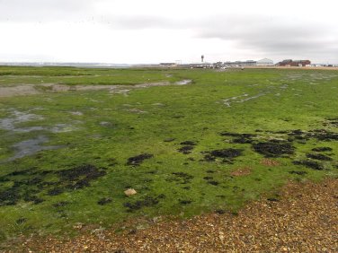 We arrived at low tide - the view across the landward side of Calshot Spit was one of marsh and mud - this made for a potentially interesting walk, as we had the whole intertidal zone to beachcomb, and a good variety of wild birds was in evidence - not all of which I could identify (although I know what Oystercatchers look like).
On previous visits here, I've found the beach littered with large, dead and dying cuttlefish - possibly indicating that the waters here are a breeding ground for them - as I understand these cephalopods die off in large numbers after reproducing.
In places, the beach on this side is composed almost entirely of tiny whelk shells.
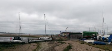 At around about the middle of the spit, there is an untidy little huddle of boats and sheds - there is a short section of harbour wall and the beach cannot be traversed - so at this point, we headed directly for the castle.
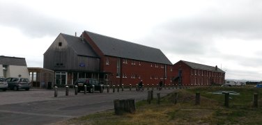 Looking back, there are the red brick dormitories and buildings of Calshot Activities Centre - an outdoor activities and environmental studies facility used by schools, colleges, businesses and other groups for field trips, outdoor sporting activities and team building.
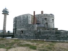
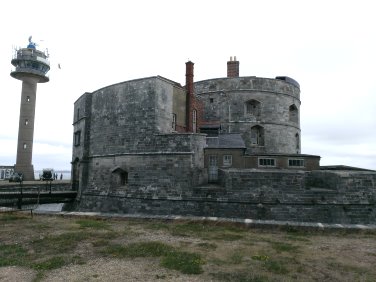 At the tip of Calshot Spit is Calshot Castle - like several other castles in this area, this one was built by Henry VIII to defend the port of Southampton, but was later adapted and used by the Navy and RAF.
The castle is surrounded by a moat contained within a thick outer wall - when we visited, a small, steep section of beach was exposed on the seaward side of the outer wall, but at high tide, the only way to go around the castle is to walk on top of the wall itself (which is not a problem).
The Tall structure also shown in this photo is the observation and radar tower of Calshot Lifeboat Station.
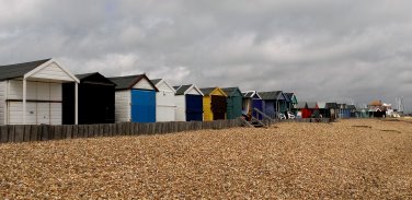 Heading back along the seaward side of the spit, and onto Calshot Beach, rows of colourful beach huts may be seen - bustling with occupancy and activity despite this blustery, overcast day.
Or perhaps because of it - the shallow, but exposed waters to the front of these huts are very popular with kite surfers and sailboarders - many of whom probably have a beach hut to use as a base for rest and refreshment.
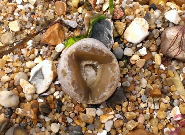 The geology of Calshot Spit is very familiar and similar to most of the other beaches of the Solent and beyond - grit and shingle, mostly composed of flint/chert - the fossil remains of sponges and other invertebrates.
This delightful little flint nodule caught my eye - about the size of a walnut and naturally already broken open in quite a pleasing, symmetric way, revealing a core of sparkling quartz crystals - this one is going in my collection.
We didn't have time to stop and hunt properly, but I suspect there are fossil shark teeth to be found here.
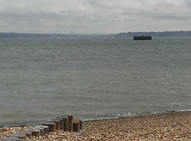 Across the water, the Isle of Wight seems tantalisingly close.
The structure in water in the foreground looks like a fort or other defensive platform, but I have been unable to uncover much information about it.
Here it is on Google Maps - if anyone has more information about this object, please let me know and I'll update this page.
And here's the answer (thanks Mark!):
The object in Stanswood Bay is the cooling water outfall for the power station, temperatures around this were a good few degrees warmer than the surrounding area when the station was in operation. Fishing off this area produced some strange results and appeared to attract creatures from warmer climes (probably the only place they could survive year round), three of the rarely seen in the UK Meiosquilla Desmaresti were caught metres from the structure back in 1985.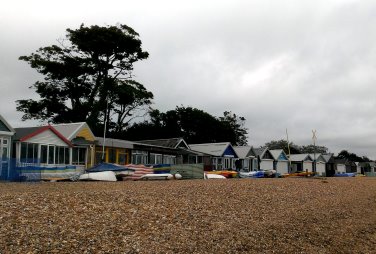 further along Calshot beach, to the south west, the beach huts get progressively larger and better appointed. Nearly all of these huts were in active use and there were lots of small watercraft, surfboards etc stacked in front.
A little further, past the beach huts, there are small cliffs lined with evergreen oaks - set in the middle of these is Luttrell's Tower - an 18th century folly believed to have been used in smuggling operations. Later, in 1912, this tower was used by Guglielmo Marconi for his radio transmission experiments.
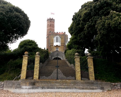
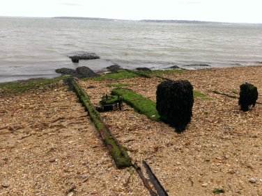 A few yards further may be found the derelict remains of what must once have been a slipway with iron rails and a winch - perhaps another lifeboat station, or some forgotten WWII relic.
End Of The Line
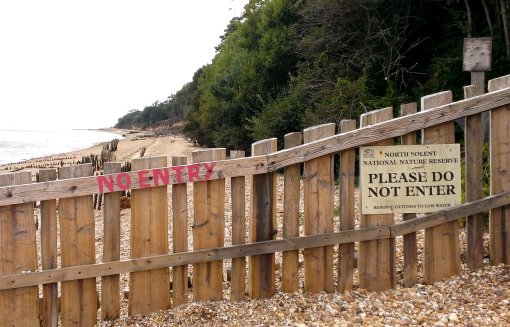
We walked to the end of Calshot beach - our intention had been to carry on all the way to Lepe, but we found our way blocked by a large fence.
This part of the shore is closed off as a nature reserve. We turned back and hoped to find a clifftop path or road that would take us to Lepe, but there does not appear to be one - the shortest accessible route would involve going back along the road at least to Calshot village - maybe as far as Holbury, then taking the road back out to Lepe.
We decided to visit Lepe another day - and instead, walked back toward Fawley Power Station.
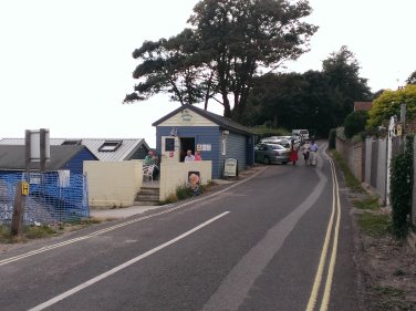 On the road running behind the row of larger beach huts on Calshot Beach, there is a small cafe serving hot and cold food, homemade cakes, tea, coffee, wines and New Forest ice cream.
It's quite a humble little place, but friendly, clean and altogether very nice.
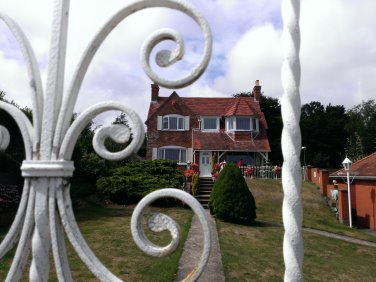 Also along this road, opposite the cafe, there are some attractive houses of assorted vintage.
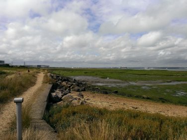 Back at more or less the place we set out, we found the path leading off toward Fawley Power Station.
From here, the power station looks just like any other random industrial building.
To the left of the path, there is an expanse of reed beds and wet, marshy grassland - buzzing with crickets and other insect life - providing an important refuelling stop for migrating birds.
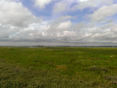 The path shows evidence of flooding at very high tides - both sides are lined with marshland plants that enjoy salt water inundation - including Purslane, Samphire and Sea Lavender.
We were tempted to pick some of the abundant Marsh Samphire, but this didn't seem like a such a brilliant idea so close to the power station, the refinery and the industrial docks of Southampton.
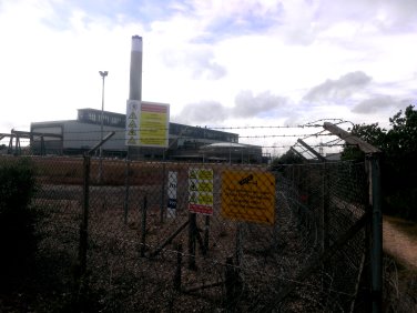 From a distance, Fawley Power Station looks just like any other random industrial building, but appearances can be deceptive - it's actually (and not surprisingly, really) a gigantic and quite imposing place.
At the rear, there's an interesting saucer-shaped concrete office complex.
Despite the industrial nature of the area, the beach and marshland around here is actually very tranquil and clean - and the sheltered bay between Calshot Spit and Fawley was filled with groups of small sailing dinghies, kayaks and other watercraft - quite fun to watch, especially with the background of the enormous ships entering and leaving Southampton Docks and the oil terminal
Boats
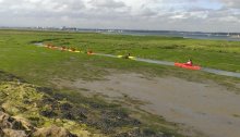 We saw a group of teenagers and their leaders paddling their kayaks through one of the channels in the marsh at mid-tide.
Birds
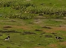 We saw a lot of different species of birds, including Oystercatchers.
Plants
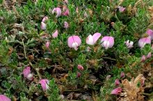
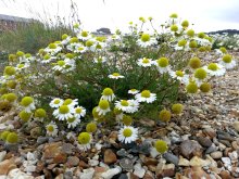 The familiar plants of shingle beaches were all here - including sea beet, sea kale - at this time, festooned with its little round corky, buoyant seed pods, but also (left) sea chamomile and (below) growing from cracks in the walls of Calshot Castle, very tough and low growing specimens of what I believe to be Ononis repens (Restharrow).
